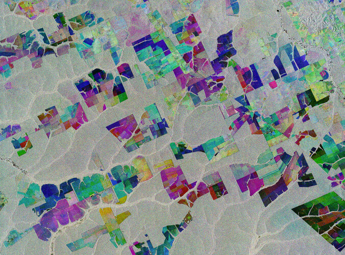
 Image: The Copernicus Sentinel-1 mission takes us over part of the Brazilian state of Mato Grosso deep in the Amazon interior. This image combines three separate radar images from the Copernicus Sentinel-1 mission taken about two years apart to show change in crops and land cover over time. Unlike images from satellites carrying optical or 'camera-like' instruments, images acquired with imaging radar are interpreted by studying the intensity of the backscatter radar signal, which is related to t...
Image: The Copernicus Sentinel-1 mission takes us over part of the Brazilian state of Mato Grosso deep in the Amazon interior. This image combines three separate radar images from the Copernicus Sentinel-1 mission taken about two years apart to show change in crops and land cover over time. Unlike images from satellites carrying optical or 'camera-like' instruments, images acquired with imaging radar are interpreted by studying the intensity of the backscatter radar signal, which is related to t...
Image: The Copernicus Sentinel-1 mission takes us over part of the Brazilian state of Mato Grosso deep in the Amazon interior. This image combines three separate radar images from the Copernicus Sentinel-1 mission taken about two years apart to show change in crops and land cover over time. Unlike images from satellites carrying optical or 'camera-like' instruments, images acquired with imaging radar are interpreted by studying the intensity of the backscatter radar signal, which is related to t...
Share this Article
Recommended